I turned 50 years old in May, which still seems odd to say out loud. I don’t really have a hangup about the number, it’s more that I feel a bit too immature to have earned it if that makes any sense. But then sometimes I’ll have conversations with younger friends, like in their 30s and early 40s and they’ll say something along the lines of “you’ve lived a lot of lives”. I guess that’s true.
Although we travel a fair bit, this felt like the kind of birthday you schedule a special trip for. Something meaningful. To me it needed to feel like an adventure and I wanted something that included a physical challenge. Because, you know, I’m not too old for those kinds of things, right? Yes, I suppose I feel the need to prove something to myself.
Through a very long maze of conversations and online research that I won’t bother detailing here, I managed to settle on a pilgrimage route in Europe. No, not that pilgrimage route. Have you heard of the Via Francigena? I hadn’t before stumbling across it online, either.
“The Via” as I’m apt to call it these days had a few points of appeal for me. One, it terminates at the Vatican. My first real travel abroad experience was a semester abroad in Rome from whence I trace the birth of my travel bug that is never satiated – oh does that make it a parasite? Secondly, it’s pretty obscure and sparsely populated particularly at the start of the journey from England into France and Switzerland. To earn the Testimonium at the Vatican a pilgrim must show proof of having walked only the approaching 100 kms starting somewhere in Italy. And that’s what a lot of people do – start in Italy – leaving the beginning part of the route quite empty of the hoards of pilgrims you might find in Spain. Others report going days without ever seeing another pilgrim, and to me that sounded like perfection. Finally, this is a long ass route. Almost 1400 miles. A fair few do the whole route in one shot walking for months, but for our schedule and purposes this is a Life Project that will take several years of trips to complete. I can’t articulate it, but for some reason that was appealing. I wonder if it’s related to my preference for book series over standalones? I recently finished the Patternist series. Anyway…
We are budgeting 12 days of walking for this chapter, which will take us from Canterbury, UK across the channel into the Hauts-de-France region with a final target of Arras, France.

The planning for this has been pretty intense. Because the first part of the route is not heavily trafficked, you cannot just show up and wing it like you can on some other routes, calling ahead each day to multiple accommodation options to see which one has room. Food options are also somewhat limited in these rural towns. If you care to roll the dice the advice is to carry a sleeping bag and tent so that you can utilize camp grounds or other potential unofficial options if you are stuck. Um, no thank you I’m done sleeping on the ground. Our typical slow travel style involves booking no more than one or two beds over a 1-3 week trip; this was quite different. Not only did I need to book 13+ places to stay, I also had to research how and where we would get food along the route.
Training hasn’t been as intense as one might think. Or perhaps my training hasn’t been as intense as it should have been. I guess time will tell. Primarily we did urban walks up to 12.5 miles in length, wearing clothes we plan to bring and carrying our packs full of the things we plan to bring. The ball of my foot just under my left big toe is prone to blisters. My average walking speed is 3 miles an hour. I haven’t had any upper body pain, and only minimal leg muscle soreness that resolves quite quickly with rest. Taking a break at a brewery around the 8.5 mile mark is ideal. The elevation gains/losses in the area of this first trip aren’t terribly significant so I’ve just been doing flat routes. Again, time will tell.
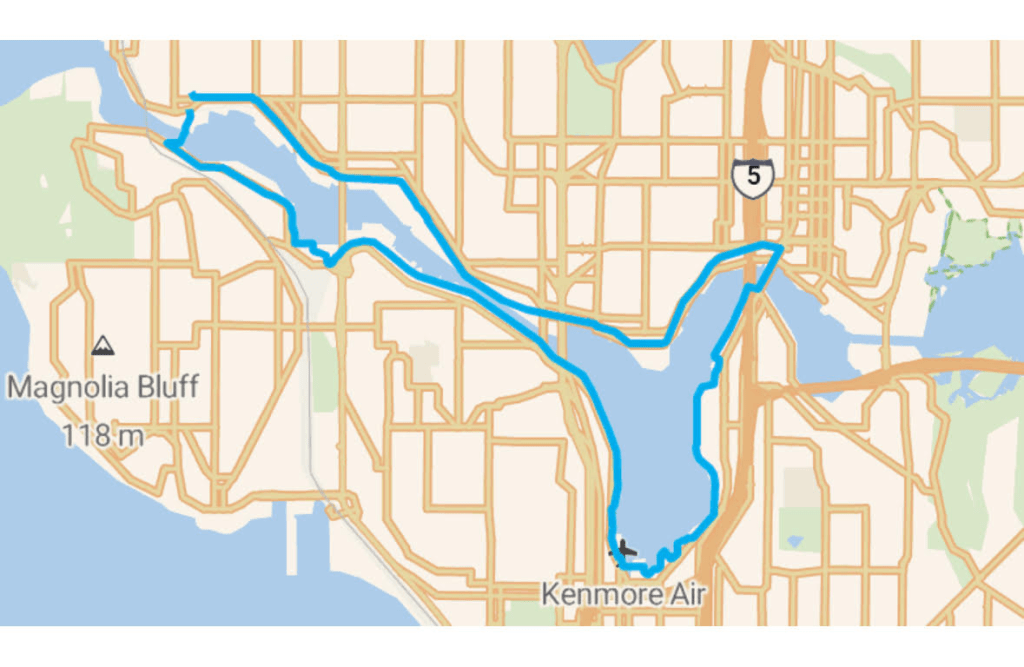
Our most common training routes have included a shorter one we call “The Fremont Loop”, and then our 12.5 mile route that circles Lake Union and includes a stop at Gasworks Brewing. Beer and smash burgers are good fuel, right?


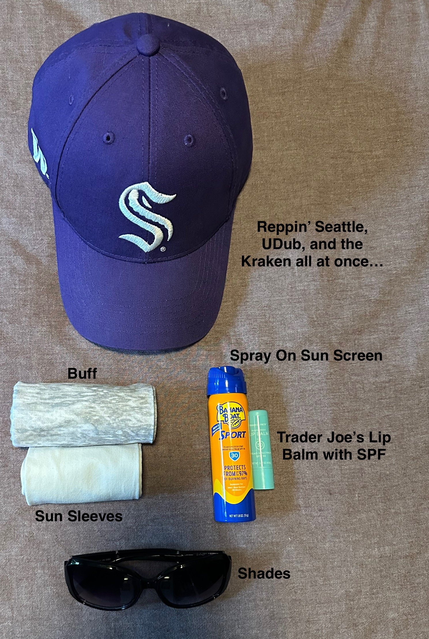
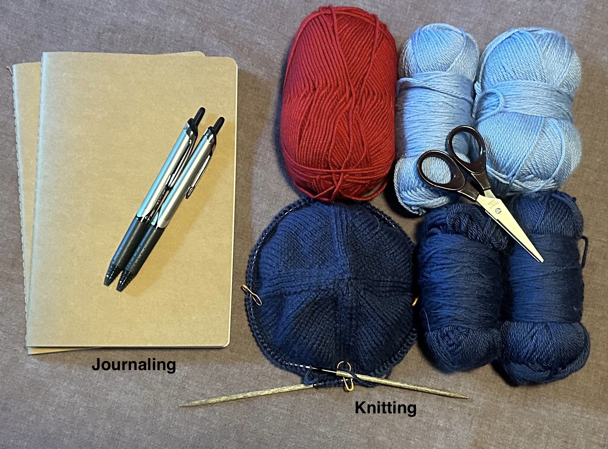
And then there’s the packing. You have to carry your own stuff every day. You need to be prepared, but limit those “just in case I need it” things. It will likely be really hot walking across farmland in July exposed to the sun, but if it rains the trails can be unbelievably muddy. After several hours of walking every day you’ll also have down time at your destination, sometimes in towns without anything to really do so how do you entertain yourself? Will the items that you wear dry overnight so you can launder them most days? Search the internet for “camino packing list” and you’ll see everyone has an opinion.
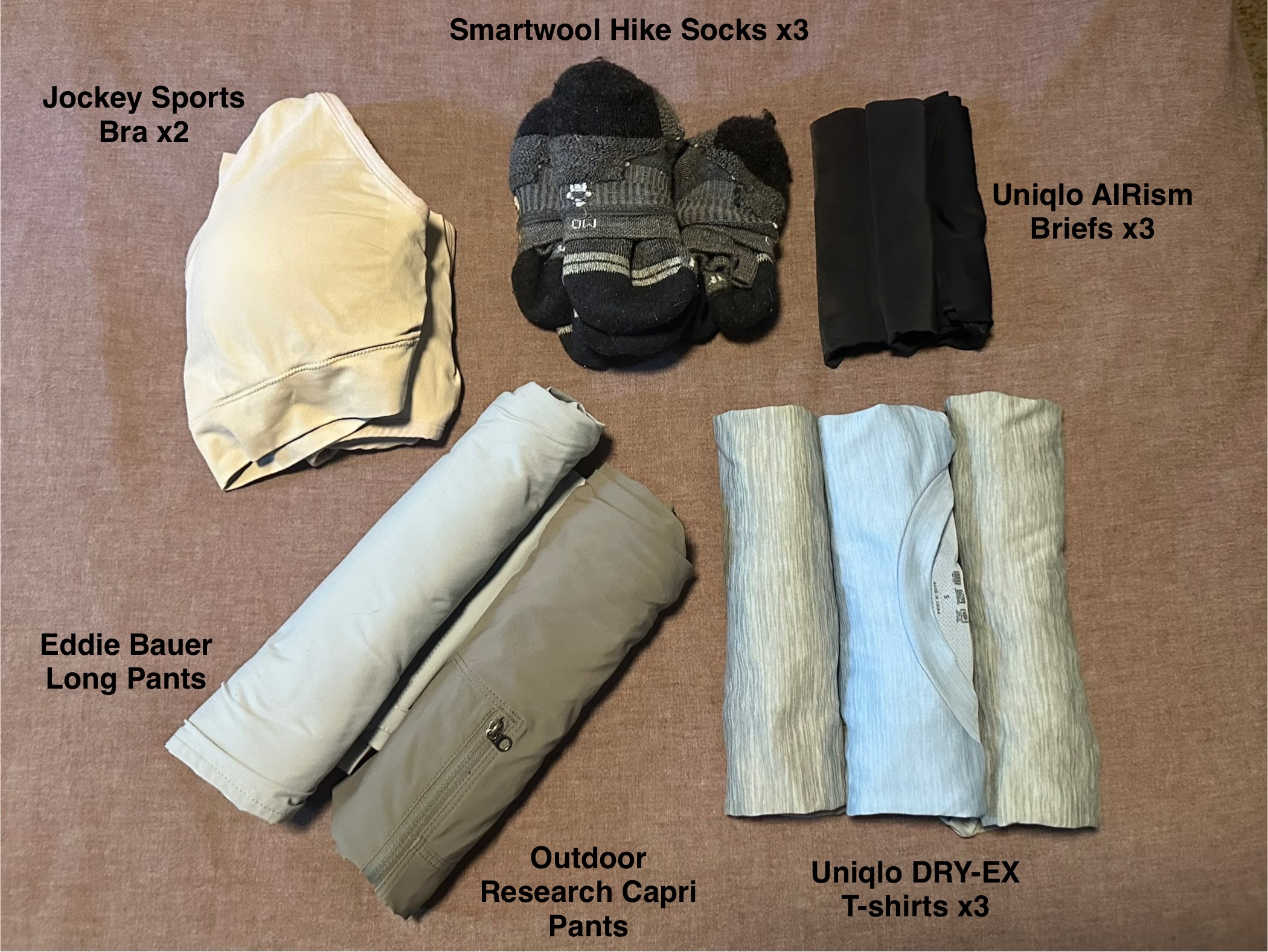
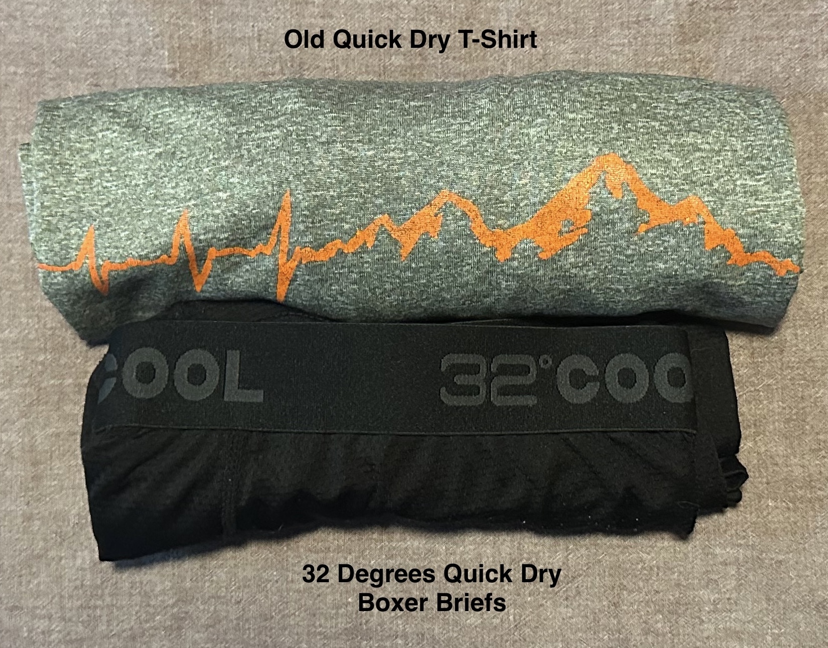
After all of the blogs and YouTube videos and guidebooks and social media posts and our own training walks, this is what I’ve settled on that’s worth carrying. I haven’t weighed it, but I’ve done a bunch of long walks carrying my pack with almost everything here, so it’ll be fine, right? Right? RIGHT?


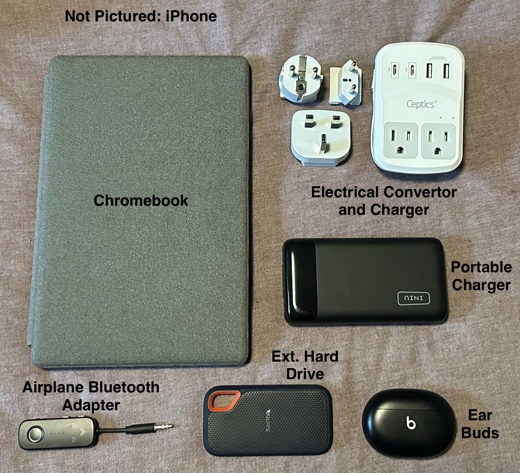

In addition to these physical items, the following are loaded onto my phone as resources for this trip:
- The Via Francigena app, that includes downloaded walking maps for offline use (the icon is blue with a white outline of the pilgrim logo)
- The AllTrails app with our stages downloaded for offline use as a backup option
- The Kindle app, with downloaded copies of Sandy Brown’s Cicerone Guide, and the Chinn/Gallard Lightfoot Guide
- The Relive app to track our own path and create videos
- TripIt to keep track of all of our transportation and accommodation bookings
Time has run out for my overthinking and overplanning; all that remains is getting on that plane tomorrow…
